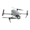
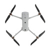
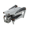
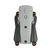
Autel EVO Max 4T
- Autel Evo Max 4T to konstrukcja o imponujących możliwościach: zaawansowana optyka oraz
- termowizja wspomagane są inteligentnymi
- algorytmami analizy obrazu. Zastosowania drona obejmują m.in. misje ratownicze, zdalne inspekcje czy modelowanie 3D.
Autonomiczny dron z dwiema kamerami, termowizją i dalmierzem laserowym
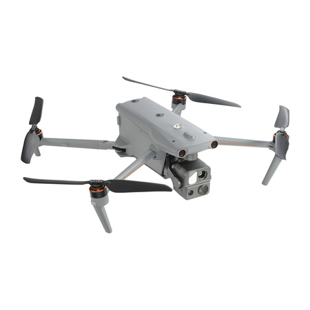
Autel Evo Max 4T to konstrukcja o imponujących możliwościach: zaawansowana optyka oraz termowizja wspomagane są inteligentnymi algorytmami analizy obrazu. Zastosowania drona obejmują m.in. misje ratownicze, zdalne inspekcje czy modelowanie 3D.
Możliwości sprzętowe
- Czas lotu: do 42 minut
- Zasięg: do 20 km streamu wideo 1080p @30FPS
- Wymiana baterii w trybie hot-swapping
- A-Mesh Technology: możliwość tworzenia sieci typu Mesh przez flotę dronów
- Obiektyw szerokokątny (ekwiwalent 23 mm) 50MP
- Teleobiektyw z zoomem optycznym (ekwiwalent 64-234 mm) 48MP
- Klasa szczelności: IP43
- Modułowa konstrukcja (wymienny gimbal, opcjonalne akcesoria)
Najważniejsze cechy software’u
- Unikanie przeszkód w 720 stopniach
- Rozpoznawanie obiektów z wykorzystaniem sztucznej inteligencji: ludzi, samochodów osobowych, samochodów ciężarowych, łodzi, zwierząt
- Typy misji przystosowane do scenariuszy wykorzystania drona
Specyfikacja techniczna
Dron
| EVO Max 4T Weight |
3.57 lbs (1620g, battery and gimbal
included)
|
|
Max. Takeoff
Weight
|
4.41 lbs (1999
g)
|
| Dimensions |
562*651*147 mm (unfolded, incl.
propellers)
318*400*147 mm
(unfolded, excl. propellers)
257*145*131 mm (folded, excl.
propellers)
|
| Diagonal Wheelbase |
1.53 ft (466mm) |
| Max Ascent Speed |
8m/s |
| Max Descent Speed |
6m/s |
| Max Horizontal Speed (windless near sea level) |
23m/s
*Maximum speed in Ludicrous Mode
is 19m/s when operating in EU
regions.
|
| Max Takeoff Altitude |
14,764ft (4500m) |
| Max Flight Time (windless) |
42 mins |
| Max Hovering Time (windless) |
38 mins |
| Max Wind Resistance |
27mph*
*Takeoff and landing can withstand wind speeds up to 27 mph
(12 m/s).
|
| IP Rating |
IP43 |
| Max Tilt Angle |
35° |
| Max Angular Velocity |
Pitch: 300°/s; Yaw: 120°/s |
| Operating Temperature |
-4°F to 122°F (-20℃ to 50℃) |
|
Internal
Storage
|
128GB internal
storage, with 64GB of available space* (Remaining available space
will vary with different firmware versions)
|
| Operating Frequency |
2.4GHz/5.8GHz
5.2GHz (only applicable
for FCC, CE, and UKCA
regions).
900MHz (only applicable for FCC regions).
|
| GNSS |
GPS+Galileo+BeiDou+GLONASS |
| Transmitter Power (EIRP) |
2.4GHz: <30dBm (FCC), <20dBm(CE/SRRC/MIC)
5.8GHz: <27dBm (FCC/SRRC), <14dBm (CE)
5.15-5.25GHz: <23dBm (FCC/CE)
902-928MHz: <30dBm (FCC)
5.65-5.755GHz: <27dBm (MIC)
|
| Hovering Accuracy |
Vertically:
±0.1 m (when vision
systems working normally);
±0.5 m (when GNSS working
normally);
Horizontally:
±0.3 m (when vision systems working
normally);
±0.5 m (when GNSS working normally);
|
|
Wi-Fi
Protocol
|
802.11a/b/g/n/ac/ax
Support 2 x 2 MIMO Wi-Fi
|
|
Wi-Fi Operating
Frequency
|
2.400 - 2.4835
GHz;
5.150 - 5.250GHz (CE/FCC/MIC);
5.725 ‒ 5.850
GHz*(Except MIC)
|
|
Wi-Fi Transmitter
Power (EIRP)
|
2.400 - 2.4835
GHz
FCC:<30dBm; CE/SRRC/MIC:<20dBm
5.150 -
5.250GHz
FCC/CE/MIC<22dBm
5.725 ‒ 5.850 GHz
FCC/SRRC:
<21dBm
CE: <14dBm
|
Gimbal
| Mechanical Range |
Pitch: -135° to 45°
Yaw: -45° to
45°
Roll: -45° to 45°
|
| Controllable Range |
-90° to 30° |
| Stable system |
3-axis mechanical gimbal (pitch, yaw,
roll)
|
| Max Control Speed (pitch) |
200º/s |
| Angular Vibration Range |
<0.005° |
Teleobiektyw
EVO Max 4T Zoom Camera
(Telephoto)
| Sensor |
1/2" CMOS, Effective pixels: 48M |
| Lens |
Focal length: 11.8-43.3mm (35mm,
equivalent: 64-234mm)
Aperture:
f/2.8-f/4.8
Focusing distance: 5m ~ ∞
|
| Exposure Compensation |
±3EV 0.3EV/step |
| ISO Range |
Normal Mode:
Auto: ISO100 ~ ISO6400
Manual:
Photo: ISO100 ~
ISO12800
Video: ISO100 ~ ISO6400
|
| Shutter Speed |
Photo: 8s ~ 1/8000s
Video: 1s ~ 1/8000s
|
| Max Photo Size |
8000×6000 |
| Max Video Resolution |
4000x3000 |
Termowizja
| Thermal Imager |
Uncooled VOx Microbolometer |
| Lens |
FOV: 42°
Focal length:
13mm
Aperture: f/1.2
Focusing Distance:
6m ~ ∞
|
|
Infrared Temperature Measurement
Accuracy
|
±3℃ or reading ±3% (using the larger
value) @ambient temperature range from -4℉
to 140℉ (-20℃~60℃)
|
| Video Resolution |
640×512@30FPS |
| Photo Size |
640×512 |
| Pixel Pitch |
12 um |
| Temperature Measurement Method |
Center measurement, pot measurement, rectangular measurement |
| Temperature Measurement Range |
-4℉ to 302℉, 32℉ to 1022℉ (-20°C to
150°C, 0 to 550°C)
|
| Temperature Alert |
High and low temperature alarm thresholds, reporting coordinates and
temperature
values
|
| Palette |
White Hot/Black
Hot/Searing/Rainbow/Grey/Ironbow/Cold and Hot
|
Obiektyw szerokokątny
| Sensor |
1/1.28 CMOS, Effective pixels: 50M |
| Lens |
FOV: 85°
Focal length: 4.5 mm
(equivalent: 23 mm)
Aperture: f/1.9
AF
motor: PDAF focus
|
| Exposure Compensation |
±3EV 0.3EV/step |
| ISO Range |
Photo: ISO100~ISO6400
Video:
ISO100~ISO64000 (Night scene mode: up
to ISO64000)
|
| Shutter Speed |
Photo: 8s ~ 1/8000s
Video: 1s ~
1/8000s
|
| Max. Video Resolution |
4000×3000 |
| Photo Size |
4096*3072 |
Dalmierz laserowy
| Measurement Accuracy |
± (1 m + D×0.15%)
D is the distance to a vertical surface
|
| Measuring Range |
5m to 1.2km |
Transmisja danych
| Operating Frequency |
2.4G/5.8G/900MHz*
*900MHz is only
applicable for FCC regions.
|
|
Max Transmission Distance
(unobstructed, free of interference)
|
12.4 miles/20km (FCC), 4.9 miles/8km (CE) |
| Independent Networking |
Autel Smart Controller V3 |
| Transmitter Power (EIRP) |
2.4GHz: <28dBm (FCC), <20dBm (CE/SRRC/MIC)
5.8GHz: <28dBm (FCC/SRRC), <14dBm (CE)
5.15-5.25GHz:
<
23dBm(FCC/CE)
902-928MHz: <30dBm (FCC)
5.65-5.755GHz: <27dBm (MIC)
|
Wykrywanie przeszkód: radar 60GHz
| Frequency |
60GHz/24GHz*
*Please fly safely and comply with your local laws and regulations to use 60GHz.
|
| Sensing Range |
60GHz Radar:
Upward: 0.98-787.4in (0.3-20m)
Downward: 5.9-3149.6in (0.15-80m)
Forward and Backward: 0.98-98.43ft (0.3-50m)
24GHz Radar:
Downward: 2.62-39.4ft (0.8-12m)
|
| FOV |
Horizontal (6dB): ±60°/±22° (24G/60G)
Vertical (6dB): ±30°/±20° (24G/60G)
|
|
Operating
Environment
|
The 60GHz
millimeter-wave radar sensing system supports all-weather obstacle
avoidance for glass, water, wires, buildings, and trees. Its obstacle
avoidance
distance varies with the obstacle's ability to reflect electromagnetic
waves and
its surface size.
The 24Ghz millimeter-wave radar supports downward
sensing,
and its sensing range varies by the ground material. For example, the
sensing range
of cement ground is 12 meters, and the sensing range of grass with a
thickness of
more than 3cm is less than 6 meters.
|
Wykrywanie przeszkód: system wizyjny
Visual Sensing System
| Obstacle Sensing Range |
Forward: 19.7-1220.5in (0.5-31m)
Backward: 19.7-984.3in (0.5-25m)
Sideward: 19.7-1023.6in (0.5-26m)
Upward: 0.66-85.3ft (0.2-26m)
Downward: 0.98-75.5ft (0.3-23m)
|
| FOV |
Forward/Backward Sensor: 60°(H), 80°(V)
Upward/Downward Sensor: 180°(sideward), 120°(forward & backward)
|
|
Operating
Environment
|
Forward,
Backward, Sideward, Upward: The surface has rich texture, under
sufficient
lighting environment (>15 lux, normal indoor fluorescent lighting
environment)
Downward: The surface is a diffuse material with a
reflectivity
>20%
(walls, trees, humans, etc.), under sufficient lighting
environment (>15 lux, normal indoor fluorescent lighting
environment)
|
Wykrywanie przeszkód: system wizyjno-radarowy
| Sensing Range |
Forward & Backward: 11.8-1968.5in
(0.3-50m)
Sideward: 19.7-1023.6in
(0.5-26m)
Upward: 0.66-85.3ft (0.2-26m)
Downward: 0.49-262.5ft
(0.15-80m)
(60Ghz radar)
|
| FOV |
Forward/Backward
Sensor: 80°(H), 120°(V)
Upward/Downward Sensor:
180°(sideward), 120°(forward & backward)
|
|
Operating
Environment
|
Forward,
Backward, Upward, Downward: supports all-weather obstacle avoidance for
glass, water, twigs, buildings and high voltage lines. At least one of
the 2
conditions should be met: sufficient lighting or the obstacle has strong
reflection
ability to electromagnetic waves.
Sideward: The surface has rich
texture, under
sufficient lighting environment (>15 lux, normal indoor fluorescent
lighting
environment)
|
Aparatura sterująca
| Screen |
7.9 inch, 2000nits max. brightness, 2048*1536 resolution |
| Battery |
Capacity: 5800mAh
Battery Type: Intelligent Lithium Ion Battery
Voltage: 11.55V
Energy: 67Wh
Charing time: 120mins
|
| Operating Time |
2.5 hours (Max. brightness)
4.5 hours
(50% brightness)
|
|
Max Transmission Distance
(without
interference)
|
12.4 miles/20km (FCC), 4.9 miles/8km (CE) |
| IP Rating |
IP43 |
| Storage |
128G |
| GNSS |
GPS+GLONASS+Galileo+Beidou |
| Operating Temperature |
-4°F to 104°F (-20℃ to 40℃) |
| Wi-Fi Protocol |
WiFi Direct, Wi-Fi Display,
802.11a/b/g/n/ac
Support 2 x 2 MIMO
Wi-Fi
|
| Operating Frequency |
2.400 - 2.4835 GHz;
5.150 - 5.250GHz*(MIC only);
5.725 ‒ 5.850 GHz*(Except MIC)
|
| Transmitter Power (EIRP) |
2.400 - 2.4835 GHz
FCC:<23dBm; CE/SRRC/MIC:<20dBm
5.150 - 5.250GHz
MIC:<17dBm
5.725 ‒ 5.850 GHz
FCC/SRRC:<22dBm
CE:<14dBm
|
Akumulator drona
| Capacity |
8070mAh |
| Voltage |
14.88V |
| Battery Type |
LiPo 4S |
| Energy |
120wh |
| Net Weight |
1.15 lbs (520g) |
| Charging Temperature |
-4° F to 113° F (-20ºC to 45ºC)
When the temperature is lower than 41° F (5° C), the selfheating function will be automatically activated. There should be at least around 10% of the remaining power for heating.)
|
| Hot Swappable |
Supported |
Potrzebujesz pomocy? Masz pytania?Zadaj pytanie a my odpowiemy niezwłocznie, najciekawsze pytania i odpowiedzi publikując dla innych. 
